
Technical Details
For those who like the "hard data" before they lace up their hiking boots:
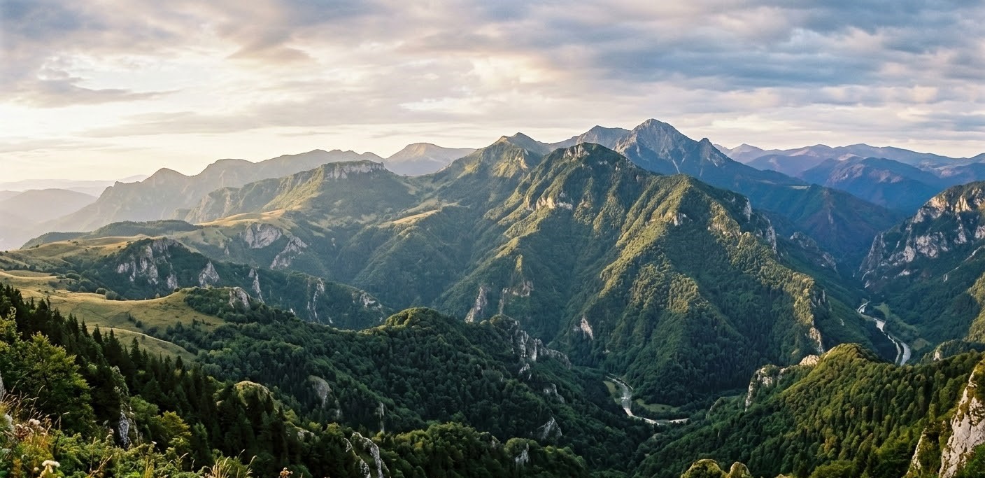
- Highest Peak: Curcubăta Mare (1849 meters), which is also the highest point in the entire Western Carpathians.
- Geology: Predominantly limestone and crystalline schists, which created the highest density of caves and karst formations in Romania.
- Climate: Known for high precipitation, which keeps the landscape lush and green year-round.
- The Bihor Mountains are a sanctuary for flora and fauna that have disappeared from much of Western Europe.
- The Big Three: You can still find the "Carpathian Trinity" here—the brown bear (see more), the wolf, and the elusive lynx.
- Flora: The limestone ridges are home to the Edelweiss (Floarea de colț) (see more), a protected mountain flower. You’ll also find vast forests of spruce and beech, and in the early summer, the mountain meadows are carpeted in wild orchids and peonies.
- The Glaciers: Inside caves like Scărișoara (see more), you’ll find ancient ice that has survived for over 3500 years, harboring unique microorganisms.
Legends and Folk Tales
The locals, known as Moți, have a deep spiritual connection to these peaks.
The Fairies of the Peaks: It is said that the high plateaus are guarded by Vâlve—spirits of the mountains. Some are "white" (good) and help lost travelers, while others are "black" (tricky) and hide the gold veins from greedy miners.
The Dragon of Solotruc: Legend has it that a massive dragon once lived in the deep karst sinkholes. The strange sounds heard from the underground rivers during heavy rains are said to be the dragon’s snoring as it sleeps beneath the Earth's crust.
Fun Facts & Curiosities for Foreigners
- The "Swiss Cheese" Mountains: The Bihor range is so riddled with caves (over 1500 in the region) that you are often walking over massive underground cathedrals without even knowing it.
- The Wood Culture: The Moți people are famous for their woodworking. For centuries, they traveled across Romania in horse-drawn carts to sell hand-crafted wooden buckets and musical instruments called Tulnic (similar to the Alpine horn).
- Underground Ice: Scărișoara Ice Cave houses the second-largest underground glacier in southeastern Europe. Even in the middle of a 30 degrees C summer, the temperature inside remains near 0 degrees C.
If you want to experience a place where "rural" isn't a marketing term but a way of life, the Bihor Mountains are it. You can hike to the Padiș Plateau, see the massive natural fortress of Cetățile Ponorului, and finish the day with a glass of local pălincă and a slice of plăcintă moțească (traditional pie).
Pro Tip for Travelers
If you are visiting a local household, it is customary to be offered Pălincă (strong fruit brandy). It is polite to take a sip, but be careful—it usually has an alcohol content of over 50%!
A beautiful aerial video presenting Bihor Mountains (Munții Bihor):
Frequently Asked Questions: Bihor Mountains (Munții Bihor)
1. What is the best time of year to visit?
The ideal hiking season is from late May to early October.
- Spring (May-June): Perfect for seeing wild orchids and the lush green plateaus, though some high-altitude trails may still have snow patches.
- Autumn (September-October): Offers stable weather and stunning "rusty" colors in the beech forests.
- Winter (December-March): Great for skiing at Vârtop or snowshoeing, but many remote karst areas become inaccessible without professional gear.
While the trails are generally well-marked (look for the colored stripes, crosses, or triangles on trees and rocks), we recommend hiking with a partner. The Bihor Mountains are home to brown bears and wolves. While they usually avoid humans, it is important to make noise while walking and never leave food outside your tent.
3. Do I need a permit to visit the caves?
Show Caves: Places like Scărișoara Ice Cave or Bear’s Cave (Peștera Urșilor) have entry fees (usually around 20-40 RON) and set visiting hours.
Wild Caves: Many caves in the Padiș area are "wild." Some require professional caving equipment and permits from the Mountain Rescue (Salvamont) or protected area administrators. Always check local regulations before entering non-tourist caves.
4. How do I get to the Padiș Plateau?
The Padiș Plateau is the "heart" of the Bihor Mountains. The most common access point is via the town of Beiuș, following the road through Pietroasa. While parts of the road have been improved, expect some gravel sections; a car with decent ground clearance is recommended.
5. Can I find English-speaking guides?
In larger hubs like Arieșeni or Vârtop, you can find local guesthouses (pensiuni) that can connect you with English-speaking mountain guides. Younger locals generally speak English well, but learning a few basic Romanian phrases will go a long way with the Moți villagers.
6. What is the "Cetățile Ponorului"?
Often called the "Everest of Romanian Karst," this is a massive natural fortress consisting of three large rocky amphitheatres and a giant cave portal over 70 meters high. It is a must-see, but the trail involves steep descents and metal cables, so it requires a moderate level of fitness.
7. Is there mobile phone reception?
In the valleys and deep karst depressions (like the bottom of sinkholes), signal is often non-existent. On the ridges and peaks like Curcubăta Mare, reception is usually good. We highly recommend downloading offline maps (like Locus Map or AllTrails) before heading out.
